Topo Map Orientation (True North vs Magnetic North)
All of the topographic maps on the USGS site are displayed and printed with true north up. If you are using a compass in the field to navigate using a topo map you’ll need to know the “declination” of magnetic north (where your compass will point) and true north (straight up on printed topo maps). Knowing the degree difference between the two points helps orient the map to match the real world.
Note that the magnetic declination changes as you move around the United States or beyond. You should also know that the magnetic north location is constantly changing within the Earth!
Map and compass navigation is a topic for another day, but for now you should at least look up the magnetic declination for the location where you’ll be traveling. Do this before your trip and note the declination. The best resource is the lookup tool from NOAA:
NOAA Magnetic Declination Calculator
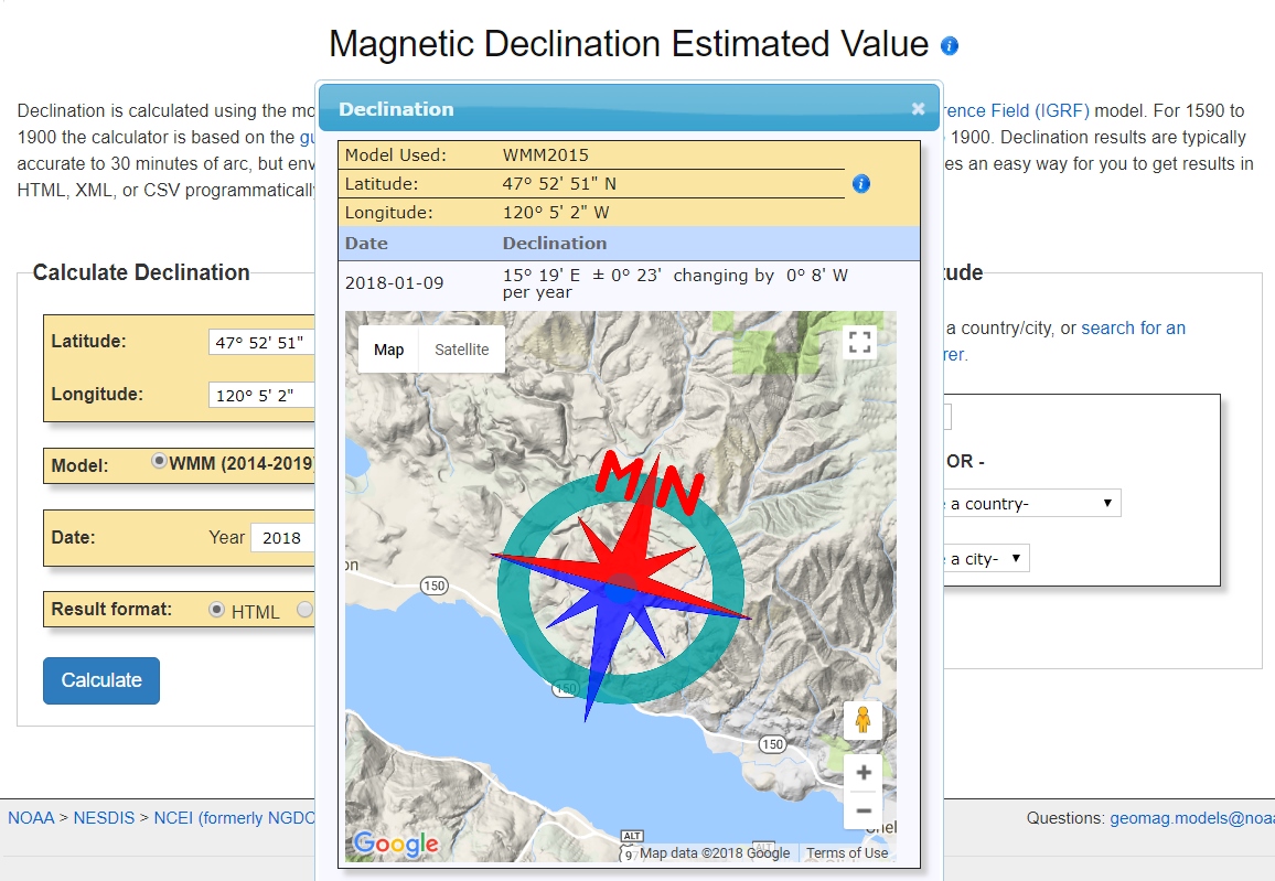
In this tool, select a city near the location where you’ll be and it will fill in the latitude and longitude for you. Hit “Calculate” and you’ll get magnetic north provided in degrees and minutes plus a map showing the declination from true north. Keep all the defaults in the tool for USGS maps as they are all in the NW hemisphere. Below is a sample NOAA declination map.
Let us know we missed anything and be careful out there.

Leave a comment
Comments will be approved before showing up.
Also in News & Skills

8 CAMPING HACKS FOR COOL WEATHER CAMPING
Sign up to get the latest on sales, new releases and more …
© 2026 HMWOutdoors.
All rights reserved.
Powered by Shopify
Richard White II
Author